
|
| |
 |
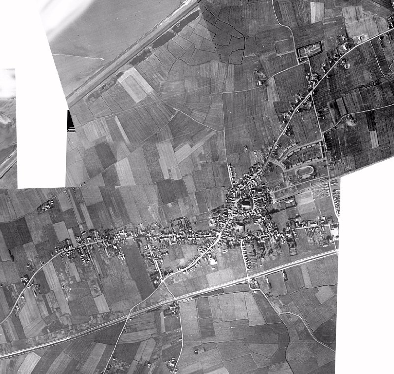
 Hippolytushoef in the second worldwar On 5 and 29 October 1944 these pictures were taken by reconnaisance planes. I used them to make this composite picture of the village of Hippolytushoef in those days. The most interesting part of it is that you get a complete picture of the village, something you won't easily get to see on normal pictures. The most striking features are the cycling track with its banked corners (demolished shortly after the war when cycling wasn't that popular anymore) and the "Helderse Buurt" (Helder neighbourhood) just north of that. These blocks were built in 1940 to house refugees from Den Helder, the bome of the national navy.
|